

Unlocking Precision in GIS: Exploring Skadi Series GNSS Receivers and Tilt Compensation Solutions
- Alpha RTK
- 6 days ago
- 3 min read

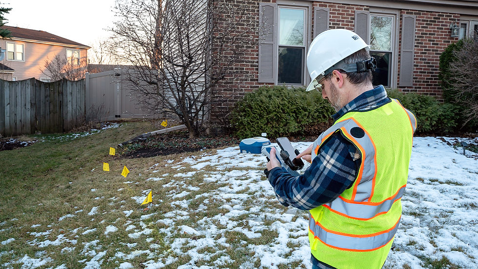
Accurate data collection is the backbone of any successful GIS project. Yet, field crews often face challenges that slow down their work or reduce precision, especially when using traditional survey equipment. The Skadi Series™ GNSS receivers from Eos Positioning Systems offer a new level of accuracy and flexibility tailored for GIS professionals, utilities, departments of transportation, and surveyors. This post explores how Skadi’s advanced technology, including its unique tilt compensation and smart handle features, can transform your field data collection with RTK-level precision.

1. Skadi Series GNSS Receivers Deliver High Accuracy and Flexibility
The Skadi Series includes the Skadi 100, Skadi 200, Skadi 300, and Skadi Gold models, each designed to meet the demanding needs of GIS and surveying professionals. These receivers provide:
Centimeter-level RTK accuracy that supports precise mapping and asset management.
Compatibility with multiple satellite constellations, improving signal reliability in challenging environments.
Flexible configurations to suit different field workflows, from simple data collection to complex surveying tasks.
By offering a range of options, the Skadi Series allows crews to select the right tool for their specific project needs without compromising on accuracy or productivity.
2. Skadi Tilt Compensation Eliminates Errors from Pole Tilting
One of the biggest challenges in field data collection is keeping the survey pole perfectly vertical. Even slight tilts can introduce errors that affect the accuracy of GNSS measurements. Skadi Tilt Compensation addresses this issue directly:
It is the first tilt compensation solution designed specifically for the GIS market.
The system corrects errors caused by pole tilt during data capture, reducing inaccuracies to about 0.3 millimeters (0.01 inches) per degree of tilt.
This feature is ideal for crews who use range poles and require RTK-level precision.
It saves time by eliminating the need to level the pole at every point, speeding up data collection without sacrificing accuracy.
This tilt compensation upgrade is available for the Skadi 200, Skadi 300, and Skadi Gold, making it accessible to a wide range of users.

3. Skadi Smart Handle Enhances Productivity with Virtual Range Poles
The Skadi Smart Handle adds another layer of innovation to the Skadi Series by integrating precise LiDAR and MEMS sensors. This technology enables two powerful features:
Invisible Range Pole: Field workers can collect data without a physical range pole.
Extensible Virtual Range Pole: Users can extend a virtual range pole, allowing measurements from difficult or unsafe locations without repositioning.
These features improve safety and efficiency, especially in complex environments like dense urban areas or rugged terrain. The Smart Handle works seamlessly with the Skadi Series 200, 300, and Gold receivers, making it a valuable upgrade for teams looking to boost field productivity.

4. Practical Benefits for GIS, Utilities, DOT, and Surveying Teams
The combination of Skadi GNSS receivers, tilt compensation, and the Smart Handle offers clear advantages for professionals in various fields:
GIS professionals can collect more accurate spatial data faster, improving the quality of maps and databases.
Utility crews benefit from reduced setup time and fewer errors when mapping infrastructure like pipelines and power lines.
Departments of Transportation can conduct surveys with greater confidence, supporting safer and more efficient road planning.
Surveyors gain a reliable tool that reduces manual adjustments and improves data consistency across projects.
For example, a utility crew mapping underground cables in a trench can use the Extensible Range Pole feature to avoid getting in the trench while maintaining RTK accuracy. Meanwhile, a DOT survey team working on a highway project can speed up data collection by using tilt compensation to avoid constant pole leveling.
5. How to Get Started with Skadi Series and Tilt Compensation
Implementing Skadi technology in your workflow is straightforward:
Choose the Skadi receiver model that fits your accuracy and budget needs.
Add the tilt compensation upgrade if your work involves range poles and requires centimeter-level precision.
Consider the Smart Handle for enhanced productivity, especially if your fieldwork involves complex or constrained environments.
Train your field crews on the new features to maximize their benefits and reduce errors.
AlphaRTK provides support and resources to help teams integrate Skadi receivers smoothly into their existing GIS and surveying operations.


Comments