

Unveiling RTK Accuracy for Precise Applications
- Alpha RTK
- Oct 30, 2025
- 4 min read

Updated: Feb 2
When it comes to getting exact location data, nothing beats Real-Time Kinematic (RTK) technology. It’s the go-to method for professionals who need pinpoint accuracy in their work. Whether you’re mapping land, managing crops, or engineering a new structure, RTK can make a huge difference. But how does it really perform? Let’s break down the nuts and bolts of RTK and its precision.
Understanding Precision in RTK Technology
RTK technology uses satellite signals to provide real-time corrections to GPS data. This means it can deliver location information with centimeter-level accuracy. The system relies on a base station and a rover. The base station stays fixed and sends correction data to the rover, which is the moving receiver. This setup reduces errors caused by atmospheric conditions, satellite orbit errors, and signal delays.
The precision in RTK technology is what sets it apart from standard GPS. While regular GPS might give you a location within a few meters, RTK narrows that down to a few centimeters. This level of detail is crucial for tasks like land surveying, construction staking, and precision agriculture.
Here’s why it matters:
Reduced errors: RTK corrects GPS errors in real time.
Faster data collection: No need to wait for post-processing.
Improved efficiency: Accurate data means fewer mistakes and rework.
If you want to dive deeper into the technical side or explore service options, check out rtk accuracy.

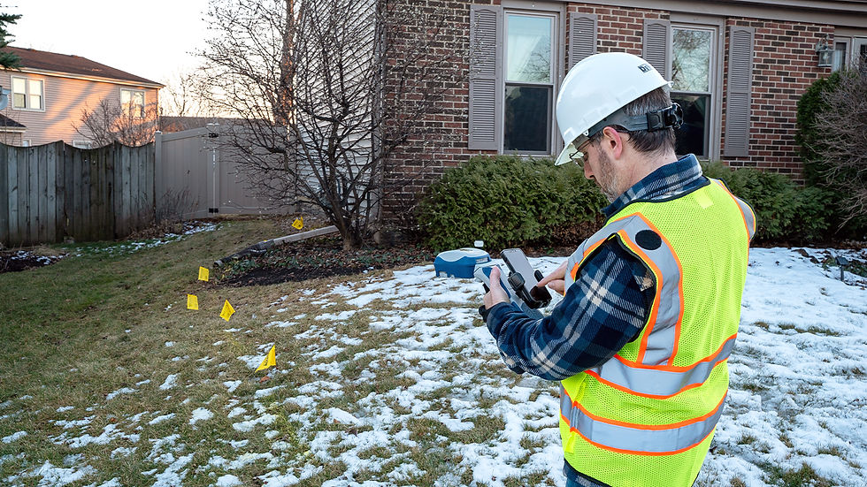
How RTK Works in Real-World Applications
RTK technology shines in fields where precision is non-negotiable. Here are some practical examples:
Land Surveying
Surveyors use RTK to map property boundaries with high accuracy. This helps avoid disputes and ensures legal compliance. The real-time corrections mean surveyors can work faster and with confidence.
Construction
Engineers rely on RTK for site layout and machine control. It guides heavy equipment to the exact spot, reducing material waste and speeding up the build process.
Precision Agriculture
Farmers use RTK to optimize planting, fertilizing, and harvesting. Accurate GPS data helps apply inputs only where needed, saving money and protecting the environment.
GIS Data Collection
Geographic Information Systems benefit from RTK by capturing precise location data for mapping and analysis. This improves decision-making in urban planning, environmental monitoring, and more.
In all these cases, the key is the instant access to reliable, corrected GNSS data. This is exactly what Alpha RTK aims to provide across the Mid-Atlantic region - affordable, accurate, and easy to use.
How accurate is the RTK survey?
RTK surveys typically achieve horizontal accuracy within 1 to 2 centimeters and vertical accuracy around 2 to 3 centimeters. This level of precision depends on several factors:
Quality of equipment: Higher-end receivers and antennas improve results.
Base station location: The closer the base station, the better the correction.
Signal conditions: Clear skies and minimal obstructions help maintain signal quality.
Satellite geometry: The number and position of satellites affect accuracy.
In practice, this means you can trust RTK data for most high-precision tasks. However, it’s important to monitor conditions and equipment regularly. For example, trees, buildings, or bad weather can degrade signal quality and reduce accuracy.
Tips for Maximizing RTK Accuracy in Your Projects
Getting the most out of RTK technology requires some know-how. Here are practical tips to boost your results:
Check equipment calibration: Regularly verify that your receivers and antennas are working correctly.
Monitor satellite status: Use software tools to track satellite availability and signal strength.
Avoid obstructions: Keep the rover away from tall buildings, dense trees, and other obstacles.
Use network RTK when possible: This provides corrections from multiple base stations, improving coverage and reliability.
Plan your survey timing: Conduct surveys during times of good satellite geometry and weather conditions.
Train your team: Make sure everyone understands how to operate the equipment and troubleshoot issues.
Following these steps can save time and reduce errors, making your projects smoother and more cost-effective.
Why Choose Alpha RTK for Your Correction Services?
Alpha RTK focuses on delivering highly accurate and affordable RTK correction services in the Mid-Atlantic region. Their goal is simple - make it easy for professionals to get instant access to reliable GNSS data.
Here’s what sets them apart:
Local coverage: Tailored to the Mid-Atlantic area for optimal signal strength.
Affordable pricing: Designed to fit the budgets of small and large projects alike.
User-friendly access: Quick setup and easy connection to correction data.
Reliable support: Responsive customer service to help with any issues.
By choosing a local provider like Alpha RTK, you reduce downtime and improve your workflow. Plus, you get the confidence that your data meets the highest standards of precision.
If you want to learn more or get started, visit rtk accuracy for details.
RTK technology is a game-changer for anyone who needs precise location data. Its ability to deliver centimeter-level accuracy in real time makes it invaluable across many industries. By understanding how it works and following best practices, you can unlock its full potential. And with providers like Alpha RTK offering reliable correction services, getting that precision has never been easier.


Comments